
Wigwam Heritage Route
A short historical sequence that links Indigenous landscape context, Taft-era settlement traces, and the CCC fire-tower era on Wigwam Hill.
View route on map
Opens the interactive map with this story's route and stops
- 1
Nipmuc Landscape Context
Begin with the older travel landscape that gave Wigwam Hill its name.
pre colonial
Nipmuc Trail Overlook
The Nipmuc people lived throughout central Massachusetts for thousands of years before European contact. Several Mendon trails — including portions of the Wigwam Hill loop — follow ridgelines that align with documented sections of the Nipmuc Path.
- 2
Taft Homestead Foundation
Cellar-hole traces and fieldstone walls mark the 1800s homestead period.
industrial · 1876
Taft / Anchor Rock
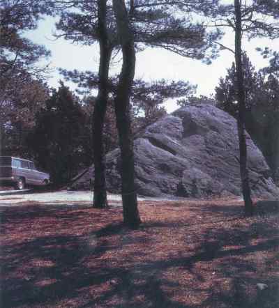
Rather than a maritime artifact, Anchor Rock gets its name from a large, deliberate carving chiseled into its surface. The rock bears the image of an anchor alongside the initials 'J.F. Taft' and the date 'April 28, 1876.' According to the Taft Family Association, J.F. Taft likely owned a sawmill in what is now the Town Forest, making this stone a lasting, personalized boundary or landmark from Mendon's late 19th-century industrial-agricultural period.
- 3
Wigwam Fire Tower Site
End at the summit footprint of Mendon's CCC-era fire lookout.
modern · 1937
Wigwam Hill Fire Tower Site
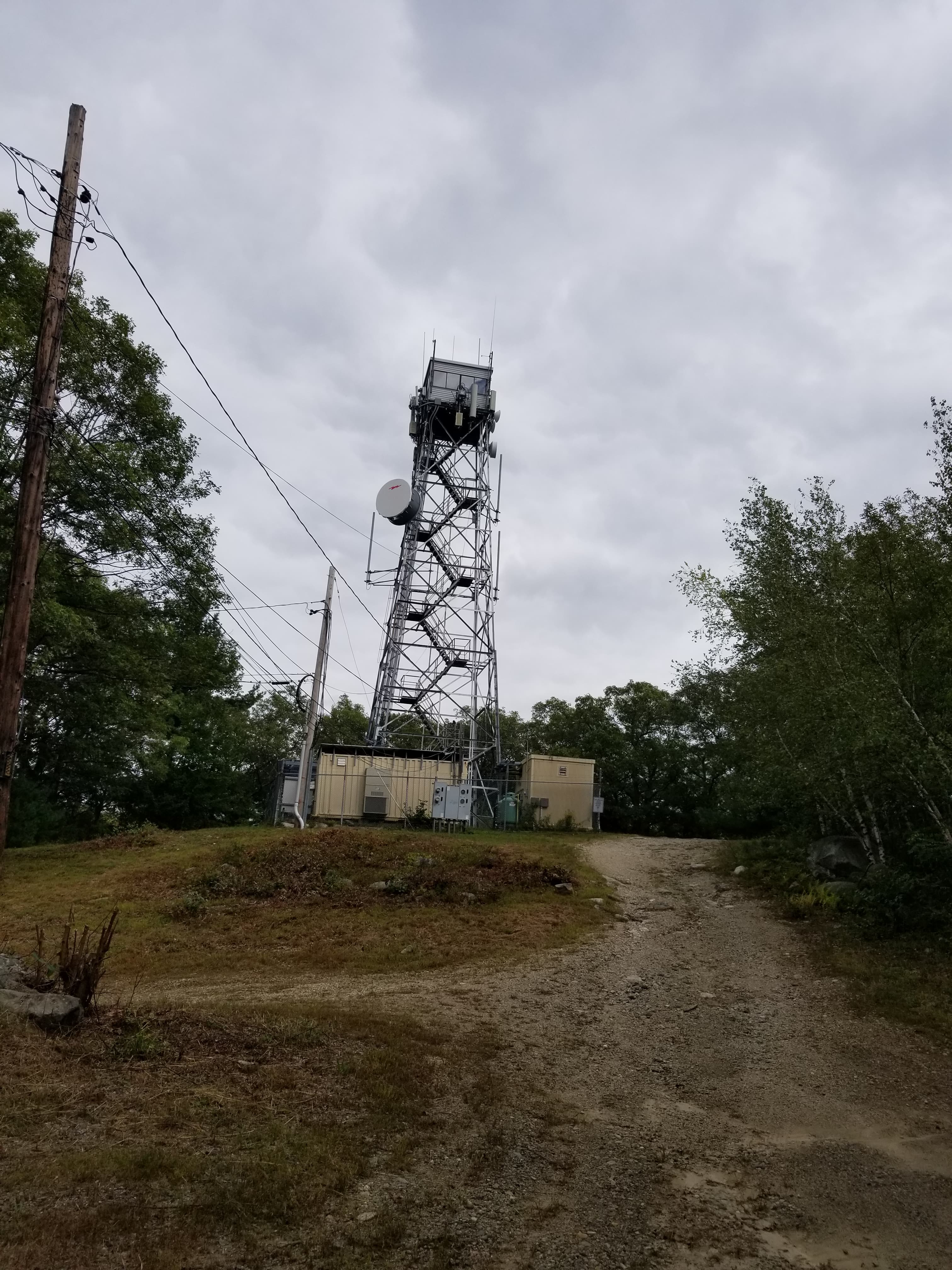
Built by the Civilian Conservation Corps in 1937 as part of the statewide forest-fire detection network, the Wigwam Hill tower stood 60 feet tall and remained in seasonal use through the late 1960s. The hill itself takes its name from a documented Nipmuc encampment area noted in 18th-century deeds.